Orientation
The area around Sandsend, laid out
The shortest useful description of this coast: what is north, what is south, what is behind, and how the pieces connect.
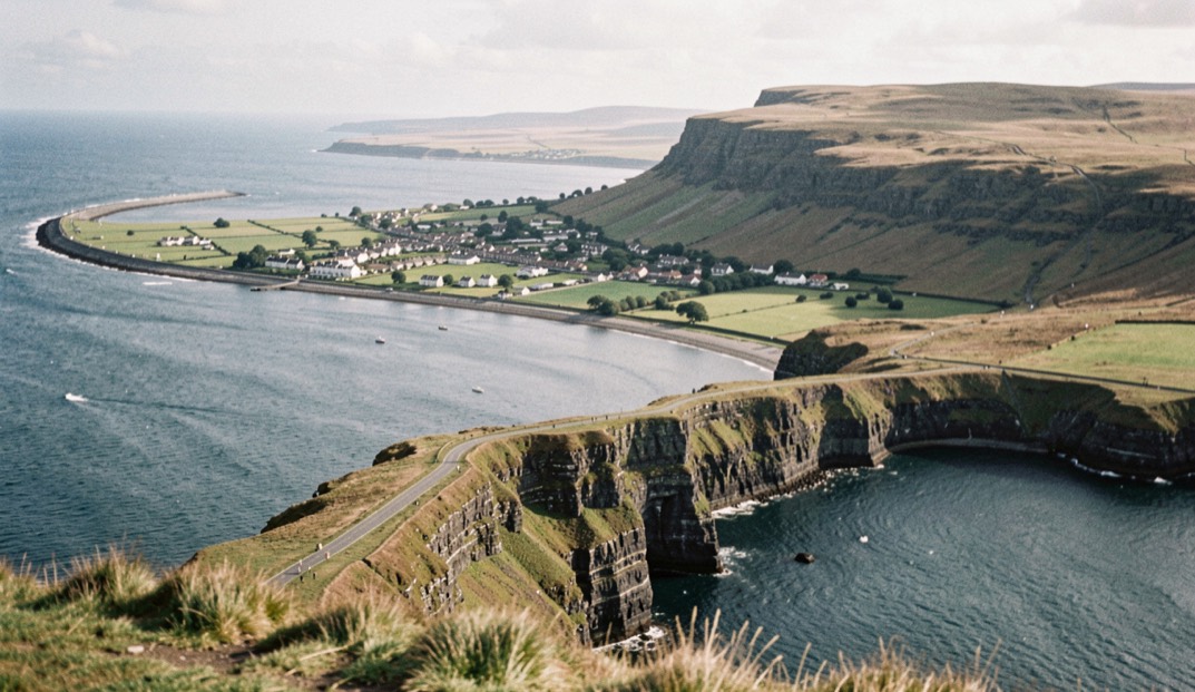
Sandsend is a fixed point on this coast, and this note sets out what stands around it: the parish it belongs to, the two becks that come down through Mulgrave Woods, the alum cliff at Sandsend Ness, the railways that ran above the houses, and Whitby where the River Esk meets the sea. The reader who wants the shape of the ground before walking it will find that shape here, one piece at a time. Nothing on this shore explains itself; each part of it was arranged by a trade, a river or a railway company.
One parish, three villages and six hamlets
Sandsend forms part of the civil parish of Lythe, a large parish inside the North York Moors National Park whose name comes from Old Norse and means hill or slope. The parish holds the villages of Mickleby and Ugthorpe as well as Sandsend, and the hamlets of Barnby, Ellerby, Goldsborough, Hutton Mulgrave, Kettleness and Newton Mulgrave. At the 2011 census it counted 377 people, down from 465 ten years earlier. St Oswald’s church at Lythe keeps registers dating from 1634, and the parish also takes in Mulgrave Castle, seat of the Marquess of Normanby, with the earthwork ruins of the older castle above it. From 1974 to 2023 all of it lay in the Borough of Scarborough; it is now administered by North Yorkshire Council.
Where does the water come down?
Two becks empty into the North Sea at Sandsend: Sandsend Beck and East Row Beck. Both flow through Mulgrave Woods before they reach the village, and the railway bridged them on high viaducts across the houses. The names carry the older geography, since the village was two places before it was one, and the becks still mark either end of the sand. The Whitby Gazette has since written the viaducts up as lost, the structures that once brought the coast together. The woods and a large part of the western side of the village, in The Valley, remain in the hands of the Mulgrave Estate.
A cliff turned into a chemical works
At the end of the 16th century Thomas Chaloner visited the alum works of the Papal States and recognised the rock being processed there as similar to the shale under his Guisborough estate. He brought workmen north in secret, and by the reign of James I alum was being produced near Sandsend Ness, three miles (5 km) from Whitby. The material served medicine, the curing of leather and the fixing of dyed cloth; once the Yorkshire works were established, imports were banned and England became self-sufficient. Whitby grew as a port on the alum and on the Durham coal brought in to process it. At Sandsend the industry has left a former cement mill and a lime kiln, which survive, listed as the Roman Cement Mill.
Two railways, one survivor
The Whitby, Redcar and Middlesbrough Union Railway ran through the village from 1855 to 1958, close to the cliffs north of Whitby. Sandsend’s station opened in 1883 and closed with the line in 1958; the encyclopaedia entry on the village tabulates those dates against the coast’s other railways. South of Sandsend the Scarborough and Whitby Railway opened in 1885 on a coastal route that needed the red brick Larpool Viaduct across the Esk Valley, and its trains reversed at Whitby West Cliff. The Esk Valley Line, completed in 1865, is the one that lasted, still running from Whitby to Middlesbrough up the valley, with the preserved steam line from Pickering reaching Grosmont and a link on to Whitby.
What can you walk on today?
On this stretch the answer is mostly railway. Sandsend sits on the coastal part of the Cleveland Way, the 110-mile (180 km) national trail, and north of the village the path follows the course of the old line. The A174, which runs from Whitby to Thornaby-on-Tees, is the road through the village, and a bus runs from Whitby up the coast to Middlesbrough for what the path misses. Southwards the trail runs over the cliff towards Whitby, a stretch set out in the note on the cliff path.
The moor behind the cliffs
Inland the ground rises into the North York Moors, an upland area designated a national park in 1952 under the Act of 1949. The park covers 1,436 square kilometres (554 sq mi), holds the largest expanse of heather moorland in the United Kingdom, and counted 22,935 residents at the 2021 census. Its biggest dale is Eskdale, and the River Esk runs the length of it from west to east before emptying into the North Sea at Whitby. The moor also makes weather for the shore: onshore winds in spring and early summer carry mists and low stratus in from the sea, known locally as “sea frets”, and heavy snow arrives on northeasterly winds off the water.
Whitby at the mouth of the Esk
Whitby is the town this shore answers to, a port and seaside town 47 miles (76 km) from York and 22 miles (35 km) from Middlesbrough, with 13,213 people at the 2011 census. The abbey ruin on the East Cliff marks a monastery founded in 657 and the synod of 664 that set the Roman date of Easter in Northumbria. The shipyards launched 11,754 tons of shipping in 1790 and 1791, the third largest output in England after London and Newcastle, and HMS Endeavour was built here in 1764 as a coal carrier before the Navy bought her in 1768. On the West Cliff a whale bone arch recalls the years when blubber was boiled in oil houses on the harbourside.
What Sandsend is, on the ground
The village itself is a small fishing settlement, and originally it was two: Sandsend and East Row were joined when cottages were built for alum workers, a joining traced in the story of the two hamlets. It was the birthplace of George Pyman, the shipping magnate, who lived from 1822 to 1900, and in 1947 its station stood in for a cliff-top platform in the opening shots of the film Holiday Camp, passengers boarding buses outside. The station has been shut since 1958; the walking now happens on the old line. From the sand at Sandsend the Cleveland Way runs north to Kettleness on the course of the rails, and the Ness and its works sit three miles (5 km) from Whitby.