Walking note
The Cleveland Way, and the cliff between Sandsend and Whitby
A national trail that starts inland and finishes on the sea cliffs. What it covers, and what the section past Sandsend is like.
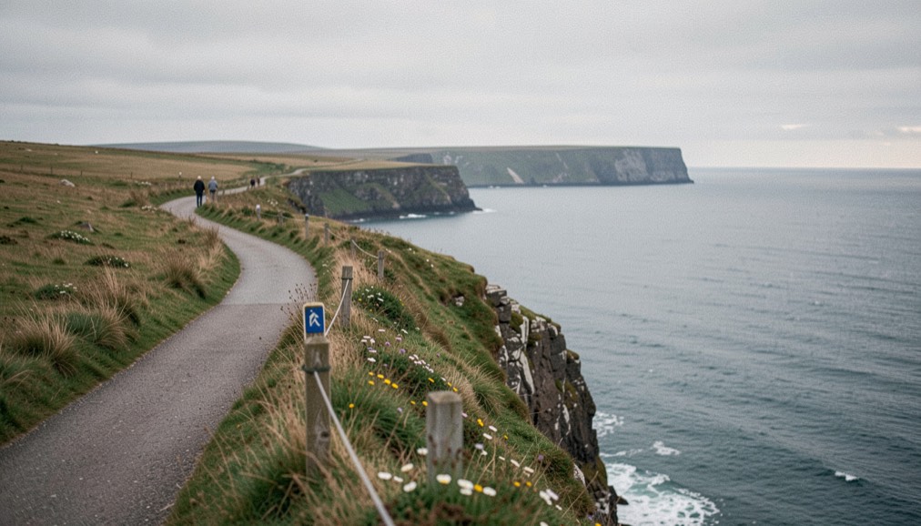
The Cleveland Way runs 110 miles between Helmsley and Filey Brigg, and for the second half of that distance it keeps to the sea cliffs of this shore. This note follows it from Saltburn, where it first meets the coast, through Sandsend and into Whitby, and sets out the distances and dates as the route’s published record gives them.
How a ramblers’ demand became a National Trail
Work on the Cleveland Way began in the 1930s, when the Teesside Ramblers’ Association pressed for a long-distance path in the north-east of Yorkshire. The route they wanted would join three things that already existed: the Hambleton Drove Road, the Cleveland escarpment and the footpaths of the Yorkshire coast. A formal proposal went to the North Riding of Yorkshire Council in 1953, submitted by the National Parks Commission. The trail opened in 1969, the second official National Trail, and it is now waymarked along its whole length in both directions with the acorn symbol carried by all of them.
Why is the route shaped like a horseshoe?
The trail runs between two trailheads: Helmsley, which stands 60 m above sea level, and Filey, on the coast. Most people walk it from Helmsley to Filey. Rather than crossing the moors, the route follows their west, north and east sides, which gives it a horseshoe shape and divides it into two roughly equal parts. One part is inland, across the hills. The other follows the sea cliffs from Saltburn to the end of the route near Filey Brigg, and it is this half that concerns the shore covered by these notes.
From Rievaulx to the sea at Saltburn
The inland half leaves Helmsley westward, past Rievaulx Abbey and Cold Kirby, to the Kilburn White Horse and Sutton Bank. It turns north along the Hambleton Hills to Osmotherley, then east across the Cleveland Hills by Carlton Bank and the B1257 road at Clay Bank. The highest point of the route comes on Urra Moor at 454 m, shortly before the path crosses the disused Rosedale Railway at Bloworth Crossing. It then runs north to Kildale, passes Roseberry Topping at 320 m, swings north-east to the south of Guisborough, crosses the A171 at Slapewath and comes down to the coast at Saltburn. The figures quoted in this note, including the total of 16,506 ft of ascent and descent over the whole route, are taken from the Wikipedia article on the trail, which lists every access point with its distance from Helmsley.
Where the trail leaves the national park
Nearly all of the route lies inside the North York Moors National Park, the area of 1,436 square kilometres designated in 1952 and administered by an authority based in Helmsley, where the walk starts. There are three exceptions: the section from Slapewath to just before Staithes, the section through Whitby, and the final section from just before Scarborough to Filey. In practice this means the path runs outside the park as it passes Saltburn and Skinningrove, returns to it for the cliffs through Runswick Bay and Sandsend, and leaves it again to cross Whitby. The acorn waymarks take no notice of the boundary; they run along the cliff tops either way.
How far along the way is Sandsend?
Access points on the route are measured from Helmsley, and the coastal ones read like a ladder of this shore. Saltburn, where the path first meets the sea, stands at 56.6 miles. The way then works along the cliff tops through Skinningrove, a former centre of ironstone mining and smelting, the fishing village of Staithes, and Runswick Bay, before it reaches Sandsend at 73.8 miles and Whitby at 76.9. Between Sandsend and Whitby the trail covers about three miles.
| Access point | Miles from Helmsley |
|---|---|
| Saltburn | 56.6 |
| Skinningrove | 60.5 |
| Staithes | 65.4 |
| Runswick Bay | 68.7 |
| Sandsend | 73.8 |
| Whitby | 76.9 |
What the path stands on at Sandsend
At Sandsend the Cleveland Way follows the course of an old railway line northwards, towards Runswick Bay. This was the Whitby, Redcar and Middlesbrough Union Railway, which ran through the village from 1855 to 1958; the station at Sandsend opened in 1883 and closed with the line. The railway crossed the village on high viaducts, bridging the two becks that reach the North Sea here, Sandsend Beck and East Row Beck, both of which flow out of Mulgrave Woods. The woods and the two becks behind Sandsend have a note of their own. South of Whitby this shore carried a second line, from Scarborough, and the old Scarborough line has one too.
Whitby, and the steps up to the abbey
The way comes into Whitby by dropping from the West Cliff and passing through the town centre. It crosses the harbour by the swing bridge, then climbs the steps to Whitby Abbey. Beyond the town the path returns to the cliff tops, through Robin Hood’s Bay and past Ravenscar, a headland that carries the remains of a failed Victorian resort development, before it reaches Scarborough. There it follows the seafront promenade beneath Scarborough Castle, goes around the harbour, and keeps to the coast to its end near Filey Brigg.
The trail in plain figures
The Cleveland Way is a National Trail of 110 miles between Helmsley and Filey Brigg, opened in 1969 as the second of the official trails, waymarked with the acorn in both directions. Its highest point is Urra Moor, at 454 m, and its total of ascent and descent is 16,506 ft. At Sandsend the route stands 73.8 miles from Helmsley; at Whitby, 76.9. The difference between those two figures, 3.1 miles, is the whole of this stretch: one village, one beach, one harbour crossing and one set of steps.
Walkers curious about the opposite kind of ground can read the note on flat-country walking, and in autumn the hedges beside the path give the sloes described in the autumn hedge note.
The walk from Sandsend to Whitby takes about two hours at an easy pace, and the cliff path climbs and falls more than the map suggests. A short detour at East Row adds little distance. Walkers who count the miles here often find the same habit useful elsewhere: break a long route into stages, carry only what the day needs, and check the tides or the weather before setting out. That approach works for a foreign trip too, as these notes on preparing a trip abroad set out.